

In recent years the insurance industry has undergone a significant transformation driven by technological advancements that streamline processes improve accuracy and enhance safety. Among these innovations drone footage also known as unmanned aerial vehicle imagery has emerged as a pivotal tool in handling insurance claims. Drones equipped with high resolution cameras sensors and advanced data processing capabilities allow insurers to capture detailed aerial views of properties vehicles and disaster affected areas with unprecedented efficiency. This shift from traditional ground based inspections to aerial documentation has revolutionized how claims are assessed verified and settled reducing timeframes minimizing risks to human adjusters and providing objective evidence that supports faster resolutions. As natural disasters and property damage incidents increase in frequency due to climate related events the role of drone footage in insurance claims has become not just beneficial but essential for maintaining operational effectiveness and customer satisfaction.
The evolution of claims assessment in the insurance sector traces back to labor intensive manual methods where adjusters physically climbed ladders inspected roofs or navigated hazardous sites to document damage. These approaches often exposed personnel to dangers such as unstable structures high elevations or post disaster environments filled with debris and unstable ground. In contrast drone technology offers a remote solution that eliminates many of these hazards while delivering superior data quality. Early adopters including major carriers like Allstate State Farm and AIG began experimenting with drones in the late 2010s securing Federal Aviation Administration approvals to integrate them into workflows. Today drone usage spans the entire claims lifecycle from initial risk assessments during underwriting to post incident damage evaluations and even fraud detection. The integration of drone captured imagery has proven particularly valuable in property and casualty insurance where visual proof of damage is central to claim validation.
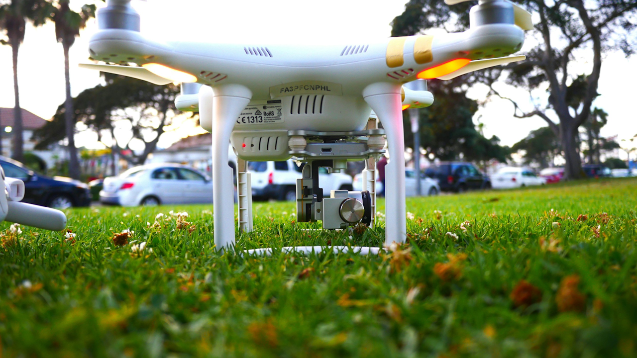
Technically drones used in insurance claims are far more sophisticated than consumer grade models. Commercial operators typically deploy unmanned aerial vehicles fitted with high definition cameras capable of capturing 4K or higher resolution still images and videos. Many incorporate thermal imaging sensors that detect moisture intrusion heat signatures from fires or structural weaknesses invisible to the naked eye. Photogrammetry software processes these visuals into three dimensional models orthomosaics and precise measurements allowing adjusters to calculate roof square footage damage extents or volume of debris without on site presence. Real time data transmission via cellular networks enables immediate review from remote locations while artificial intelligence algorithms can automatically flag anomalies such as hail impacts wind damage or flood lines. This combination of hardware and software turns raw footage into actionable insights that feed directly into claims management platforms.
One of the primary benefits of drone footage lies in the enhanced safety it provides to claims adjusters and inspectors. Traditional roof inspections for instance require climbing ladders or walking on potentially compromised surfaces which can lead to injuries or even fatalities. Drones allow operators to remain on the ground or at a safe distance while obtaining comprehensive overhead perspectives of entire properties or neighborhoods. In disaster scenarios such as wildfires hurricanes or floods where roads may be impassable and structures unstable drones can access restricted zones without endangering human life. This not only protects personnel but also accelerates response times enabling insurers to deploy resources more effectively during large scale events. Reports indicate that drone assisted inspections can be completed in approximately one third of the time required for manual methods contributing to overall adjuster efficiency gains of 50 to 60 percent in some cases.
Speed and efficiency represent additional advantages that have reshaped claims processing timelines. Conventional assessments often involve scheduling delays travel time and on site documentation which can extend the claims cycle from weeks to months. Drone deployments on the other hand facilitate rapid data collection with a single operator covering multiple sites in a day. For example Allstate has leveraged drones to produce repair estimates in as little as four and a half days following an incident a marked improvement over prior standards. High resolution imagery and automated measurements integrate seamlessly with software tools like Xactimate allowing for instant generation of cost estimates and claim validations. This reduction in cycle time from notice of loss to settlement by 30 to 40 percent translates into quicker payouts for policyholders improved customer retention and lower administrative overhead for insurers.
Accuracy and objectivity further elevate the value of drone footage in claims adjudication. Human inspections are subject to variability based on lighting conditions fatigue or perspective limitations whereas aerial imagery provides consistent top down views and multi angle documentation. Photogrammetry derived 3D models deliver exact measurements of damaged areas eliminating guesswork in repair calculations. Thermal and multispectral sensors add layers of detail such as identifying hidden water damage or assessing the extent of fire spread. These capabilities reduce disputes over claim validity and support more equitable settlements. Moreover the immutable nature of digital footage serves as reliable evidence in cases of disagreement or litigation enhancing transparency for all parties involved.
Cost effectiveness emerges as a compelling factor driving widespread adoption. While initial investments in drone hardware training and software are required the long term savings are substantial. Labor costs decrease as fewer adjusters are needed for field visits and the ability to process claims faster minimizes holding costs associated with prolonged open files. Fraud detection improves because objective aerial data can verify the timing location and extent of reported damage discouraging exaggerated or fabricated claims. Industry analyses project the drones for insurance market growing from approximately 1.2 billion dollars in 2024 to 5.5 billion dollars by 2033 reflecting the economic incentives for carriers to embrace this technology. For policyholders the result is often more accurate premiums tailored to actual risk profiles and expedited resolutions that alleviate financial stress during recovery periods.
Drone footage finds application across a wide array of insurance claim types with property insurance leading the charge. In homeowners and commercial property policies drones excel at evaluating roof damage from hail wind or storms capturing granular details of shingle displacement or structural compromise. Following natural disasters such as hurricanes or wildfires they provide rapid overviews of affected neighborhoods allowing insurers to prioritize claims and initiate outreach to policyholders even in evacuated zones. Flood and water damage assessments benefit from elevation mapping and thermal imaging that pinpoint moisture intrusion without invasive entry. Agricultural insurance leverages drones to survey crop fields for hail or drought related losses while auto claims occasionally incorporate aerial views of accident scenes for context on road conditions or vehicle positioning. Even workers compensation cases have seen drone utility in documenting hazardous workplace incidents from a safe vantage point.
The integration of drone data with emerging technologies amplifies its impact on claims workflows. Artificial intelligence and machine learning models trained on vast datasets of aerial imagery can automatically detect and classify damage types generating preliminary reports that human adjusters review for final approval. Cloud based platforms enable seamless sharing of orthomosaics and 3D models among stakeholders including policyholders contractors and reinsurers. Application programming interfaces connect drone outputs directly to core claims systems streamlining everything from initial triage to final payout. This digital ecosystem not only accelerates decision making but also creates comprehensive audit trails that support regulatory compliance and dispute resolution.
Regulatory considerations play a crucial role in the responsible deployment of drones for insurance purposes. In the United States the Federal Aviation Administration governs commercial drone operations under Part 107 regulations which mandate that operators obtain a Remote Pilot Certificate maintain visual line of sight and adhere to altitude and airspace restrictions. Waivers may be required for advanced operations such as flying beyond visual line of sight or at night both of which are increasingly common in claims scenarios. Insurers must also navigate privacy laws ensuring that footage collection respects property boundaries and data security standards. Internationally similar frameworks exist with varying degrees of stringency but the global trend points toward greater standardization to facilitate safe and ethical use. Compliance with these rules ensures that drone derived evidence remains admissible and defensible in claims proceedings.
Real world case studies illustrate the tangible benefits of drone footage in action. Following major hurricanes insurers have deployed fleets of drones to survey coastal regions capturing before and after comparisons that expedite large scale claim settlements. In California wildfire events aerial imagery enabled rapid damage categorization in inaccessible burn zones allowing one carrier to resolve 94 percent of claims within 30 days despite the chaos of widespread destruction. Roofing contractors partnering with insurers have used drones to scan entire properties post storm providing independent verification that aligns contractor estimates with adjuster findings and reduces back and forth negotiations. In one international example drone mapping documented landslide and erosion damage to a highway after heavy rains in New Zealand supplying precise volumetric data for reinstatement cost calculations and ongoing monitoring of repair works. These instances underscore how drone technology turns potential bottlenecks into efficient streamlined processes.
Despite its advantages drone footage in insurance claims is not without challenges. Weather conditions such as high winds rain or fog can limit flight operations necessitating contingency plans or delays. Battery life and flight range constrain coverage in expansive rural or disaster zones although advancements in longer endurance models are addressing this. Data volume from high resolution captures requires robust storage and processing infrastructure which smaller insurers may struggle to implement without third party service providers. Skill gaps exist as well since effective drone operation demands certified pilots trained in both aviation safety and claims specific imaging techniques. Additionally some adjusters report that while drones excel at overview documentation certain damage types like subtle hail impacts may still require supplementary ground level verification to ensure comprehensive assessments.
Ethical and societal considerations also warrant attention. The same aerial capabilities that aid claims processing have raised concerns when insurers use pre policy or periodic drone surveys to identify maintenance issues or risk factors leading to non renewals in some markets. Policyholders may perceive this as intrusive surveillance prompting calls for greater transparency and consent protocols. Balancing the efficiency gains with privacy protections remains an ongoing dialogue within the industry and among regulators. Nevertheless when applied judiciously to active claims drone footage promotes fairness by grounding decisions in verifiable visuals rather than subjective reports.
Looking ahead the future of drone footage in insurance claims appears poised for even greater innovation. Continued advancements in autonomous flight artificial intelligence and sensor technology will enable real time damage analytics and predictive modeling that anticipate claim severity before full assessments. Integration with satellite imagery and Internet of Things devices could create hybrid data ecosystems offering holistic property insights. As regulatory frameworks mature and costs decline broader adoption across smaller carriers and international markets seems inevitable. Ultimately this technology promises to make the claims experience more responsive humane and equitable fostering trust between insurers and their customers in an era of increasing environmental and economic uncertainty.
In conclusion drone footage has firmly established itself as a cornerstone of modern insurance claims handling. By delivering safe swift and precise documentation it addresses longstanding pain points in the industry while unlocking new levels of operational excellence. As the technology evolves and integrates with complementary tools its role will only expand reinforcing the insurance sector commitment to innovation that serves both business imperatives and the needs of policyholders recovering from loss. The ongoing refinement of these practices ensures that drone enabled claims processes remain a model of efficiency and integrity for years to come.